Thanksgiving Forecast Update…
Written on November 21, 2010 at 4:46 pm, by Adam Cuker
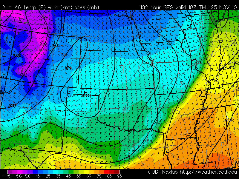
New GFS/NAM model runs are pulling both the timing and intensity of the front back a bit. Now the front looks to come in on Thursday rather than Wednesday and temperatures look to be slightly higher lows and moderately higher highs, at least for Thanksgiving.
Thursday:
On Thanksgiving morning in Central Texas, expect to wake up to rather warm temperatures and dew points in the upper 60’s. Based on the 0 to 5 degree temp/dew spread expect fog over large portions of Central Texas until slightly rising temperatures allow for gradual clearing throughout the morning. Expect the high temperature for Thanksgiving to occur sometime in the mid to late morning time frame and just before the front moves through the area around 10am to Noon, which should be around 73 degrees maximum. Immediately behind the front, winds will shift from SSW to NNW blowing colder drier air at the rate of 15-25MPH so hold on to the turkey pan around lunchtime! Expect a decent chance of precipitation along and behind the front early Thursday morning and Thursday afternoon, however since the 0c 850mb temperature line is well north of the area during the precipitation, it will be rain/drizzle instead of snow. The 850mb 0c line does push through the area Friday morning but this is long after precipitation has pushed off to the East and Southeast. Thursday evening, expect temperatures to drop to around 40 degrees by midnight and dew points below 30 degrees.
Friday:
Sunrise should bring slightly cooler temps around 34 degrees before warming quickly into the mid 50’s to lower 60’s by peak heating. Models do show a drop at the current 132 hour mark which doesn’t make sense since it is saying it drops between noon and 6pm by 15 degrees but well see in coming runs(highly doubtful). Basically though, expect cool and dry northerly air and nice conditionals during the holiday break. Enjoy it while it lasts because the high moves to our SE and southerly flow returns on the backside of the high by mid day Saturday.
Check out http://www.vortexchasers.net for updates as we move closer to next week!


No comments yet. You should be kind and add one!
The comments are closed.